Mapping Honor: The Impact of LiDAR, GPR, and Drones in Documenting Potential MIA Sites
Advanced battlefield technologies have changed how we document potential MIA sites. Tools like LiDAR mapping, ground-penetrating radar, and UAV drones provide precise data that preserve history with respect and accuracy. At Tours of Duty, these technologies empower veterans with mission-driven skills while honoring Gold Star families still seeking answers. Read on to see how this work strengthens humanitarian search missions and keeps America’s promise: No Man Left Behind. For more on the technological evolution on the battlefield, visit this link.
Advanced Technologies in Battlefield Documentation
In the realm of preserving history and honoring the missing, advanced technologies play a crucial role. From mapping to sensing, these tools help us understand and document potential sites.
LiDAR Mapping for MIA Sites
LiDAR mapping stands out as a beacon in uncovering hidden terrains. This technology uses laser pulses to create 3D models of the ground. Imagine being able to see through dense forests or heavy foliage. With LiDAR, you can. This precision helps identify potential areas worth exploring, offering a clearer picture of what lies beneath.
But how does this help? By revealing hidden landscapes, LiDAR assists in pinpointing places that were previously hard to access. For instance, areas where battles were fought or where planes might have gone down. The clarity it provides is invaluable. This tool ensures we leave no stone unturned in our quest to document history and honor the missing.
GPR Surveys in Historical Mapping
Ground-penetrating radar (GPR) is another game-changer. Unlike traditional methods, GPR sends radio waves into the ground, reflecting back to show what’s below without disturbing the site. This nondestructive approach is vital in preserving the integrity of historical locations. When we survey sites with GPR, we gather detailed images of underground structures.
This method allows us to identify potential artifacts or remains without digging. It’s like having an X-ray vision for the earth. GPR’s ability to map out subsurface features provides a roadmap for further exploration and study. This ensures our approach is respectful and informed.
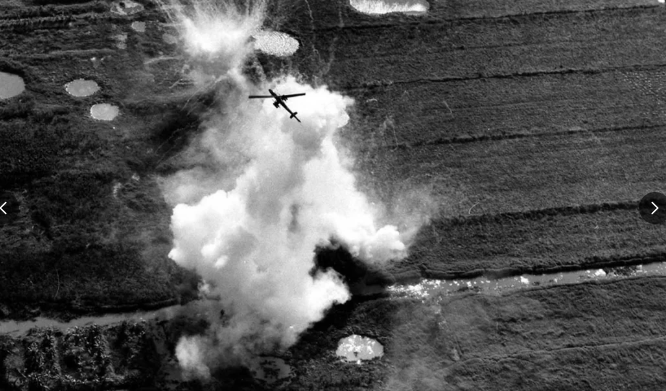
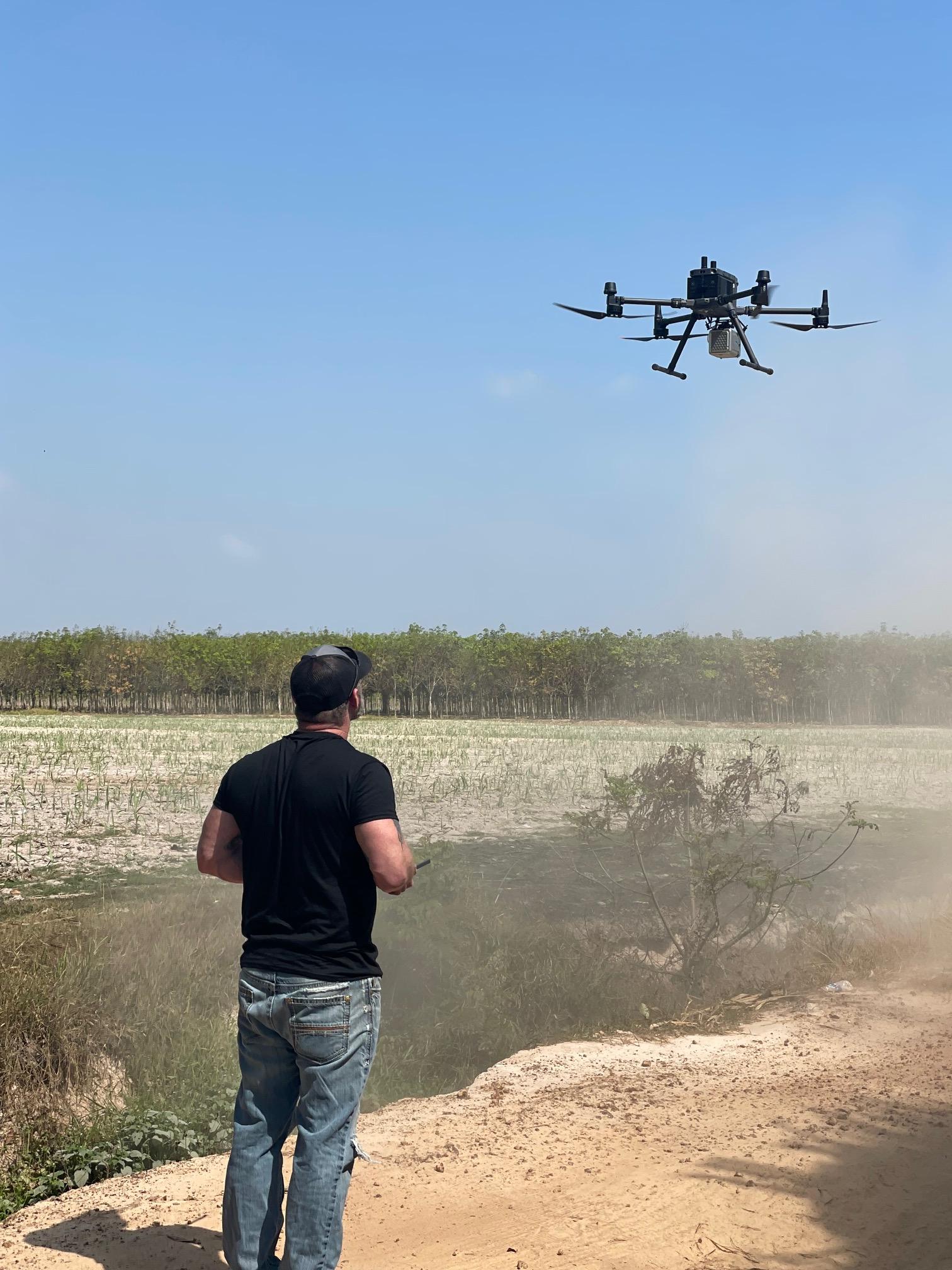
UAV Drones in Remote Sensing
UAV drones offer eyes in the sky. In places where human access is limited, drones provide a bird’s-eye view, capturing high-resolution images and videos. This aerial perspective is critical in areas that are vast or treacherous. Drones can quickly cover large terrains, gathering data that would take days on foot.
Their real-time footage helps in assessing landscapes and identifying key sites for further investigation. The efficiency and safety drones offer make them indispensable for remote sensing. By combining these advanced technologies, we bring a comprehensive understanding of potential MIA sites, ensuring that every mission is as informed and effective as possible.
For more insights into battlefield evidence and technology, see this resource.
Empowering Veterans Through Purpose-Driven Skills
These technologies aren’t just about tools; they’re about people. Veterans play a crucial role in utilizing these technologies to further humanitarian missions.
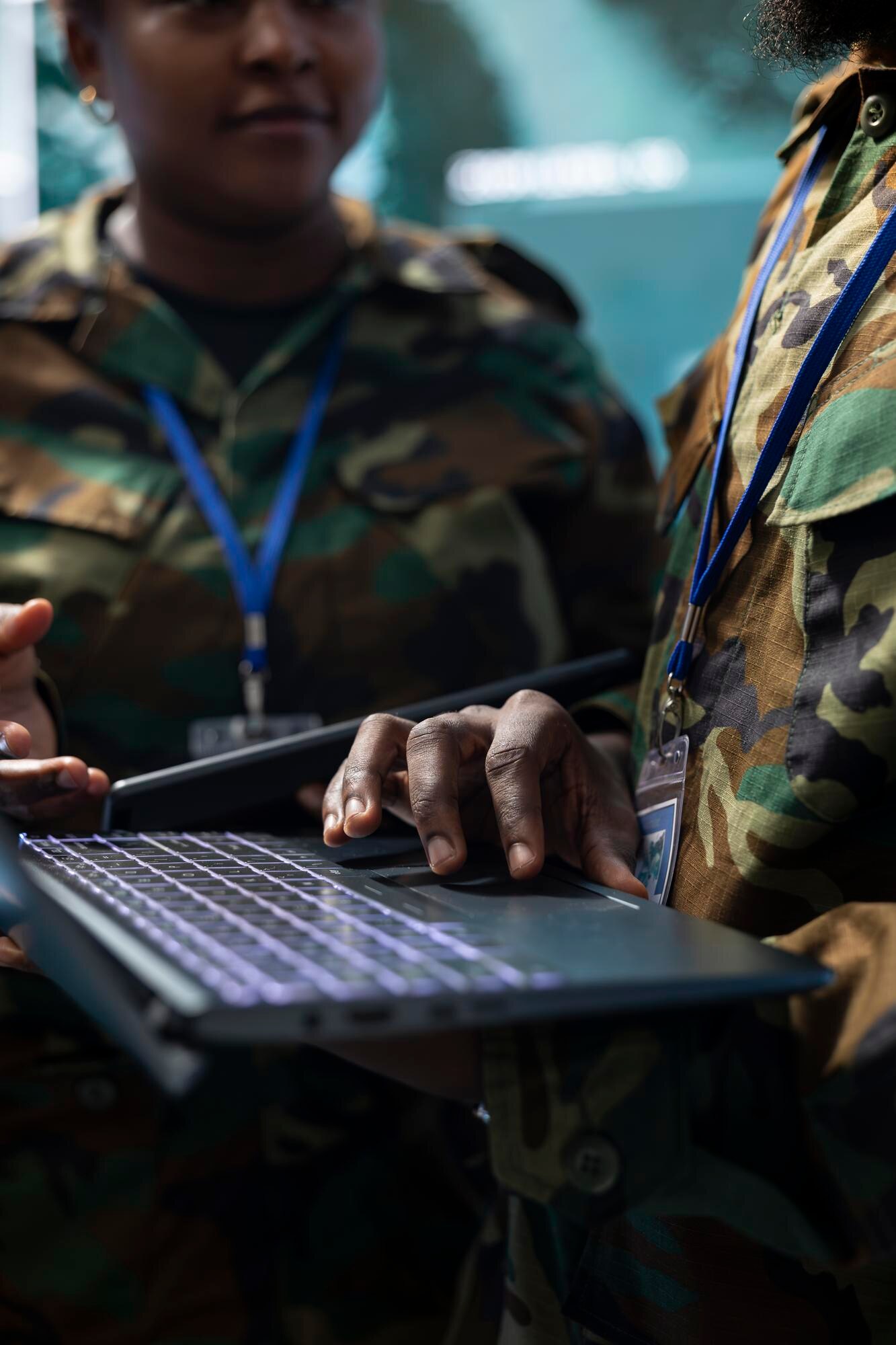
Training Pipeline for Veteran-Led Missions
Veterans are at the heart of our mission. Through specialized training programs, they gain skills in using advanced tools like LiDAR and GPR. This training transforms their military skills into humanitarian expertise. It’s a journey where they find a renewed sense of purpose.
Our pipeline ensures that veterans are equipped to lead missions, making them integral to every expedition. By engaging veterans, we not only honor their service but also give them a meaningful way to contribute to significant causes.
Forensic Field Skills in Battlefield Archaeology
Forensic field skills are another pillar of our training. Veterans learn to approach sites with an archaeological mindset. This involves meticulous documentation and analysis, ensuring that every piece of evidence is preserved. By mastering these skills, veterans enhance their ability to conduct thorough investigations.
The training includes real-world scenarios, preparing them for challenges they might face. This comprehensive approach ensures that they are ready to handle the complexities of battlefield archaeology. Their expertise helps piece together stories from the past, honoring those who served.
GIS for Battlefield Analysis
GIS technology is a powerful tool in our arsenal. By analyzing spatial data, veterans can create detailed maps of potential sites. This technology helps visualize complex data, making it easier to interpret and act upon. Through GIS, veterans can assess historical patterns and geographical changes over time.
This analysis is crucial in understanding the full scope of potential MIA sites. By integrating GIS into their skillset, veterans enhance their ability to provide accurate and meaningful insights. This ensures that every mission is strategic and well-informed. To see how GIS plays a role in modern military strategy, explore this article.
Honoring Sacrifices and Inspiring Action
Our mission is deeply rooted in honor and remembrance. It’s about connecting families, veterans, and communities to the legacy of our missing heroes.
Partnering with Gold Star Families
Gold Star families are central to our mission. We work closely with them, ensuring their voices and stories are heard. Their experiences drive us to continue our search and advocacy efforts. Partnering with these families brings a personal dimension to our work, reminding us of the sacrifices made.
Our collaboration involves storytelling and advocacy, ensuring that their loved ones are never forgotten. By engaging with Gold Star families, we strengthen our commitment to honoring the missing.
The Promise of No Man Left Behind
“No Man Left Behind” is not just a phrase; it’s a promise. This commitment drives every mission, every search, and every story we tell. It’s about ensuring that every service member’s sacrifice is remembered and honored. This promise fuels our dedication to bringing closure to families who have waited for answers.
By upholding this promise, we reaffirm our nation’s commitment to those who served. It is a principle that guides us and inspires action. This promise is what motivates our continued efforts in the field.
Engaging Communities in Humanitarian Missions
Communities play a vital role in our work. Their support and engagement make our missions possible. Through educational programs and public outreach, we raise awareness about the importance of our efforts. Engaging communities ensures that the legacy of missing heroes is preserved and honored.
We invite communities to be part of our mission, fostering a shared sense of purpose and pride. By working together, we create a lasting impact, ensuring that no service member is forgotten. For more on the digitization of POW/MIA efforts, visit this link.
This mission is more than just about finding and documenting; it’s about remembering, honoring, and healing. Join us in this journey, and together, we can keep America’s promise.